Just about anytime of year is perfect for driving this short, one hour loop through the Prescott National Forest around Thumb Butte in Prescott Arizona. Unless there has been a recent heavy rain or a rare snowfall, any vehicle with good clearance can make the somewhat dusty, dirt-road trip.
We like to take our Jeep Wrangler whenever we head off into the National Forest. There are always side roads along the way that pique our interest. Most of this drive is on a narrow, one-lane track, so an all-terrain vehicle is handy for pulling to the side to let others pass. You can expect washboards on the uphill stretch.

This field trip is noteworthy for several reasons:
 Close proximity to wilderness is popular with locals (you’ll recognize them by their friendly waves)
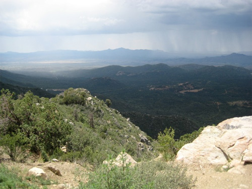
- Thumb Butte Lookout, an overlook at the top-most point offers beautiful views of Skull Valley
- Opportunities to see wildlife
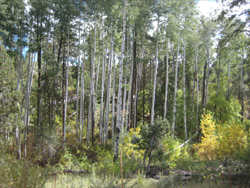
- Beautiful Aspen grove
- Rich mining history still alive in the area
- Abundant hiking trails
- Campsites, for longer stays in the forest
We like to take our leashed dog along on this drive. She loves the many well-maintained trails and roads that take off from the main route. We keep her confined as we don’t want her to wind up like the lost dog we recently came across when we made this trip. We nearly always see deer and small critters on this road; too enticing for any dog– well behaved, or otherwise.
 The All Right-Turns Route:
- Beginning at Montezuma and Gurley street corner of the Courthouse Square in downtown Prescott Arizona, travel south on Montezuma (angles right to become White Spar) through 3 lights.
- After driving 1 mile, and at that 3rd light, make a right turn onto Road.
- Begin your steady climb uphill, through neighborhoods, stopping at only one 4-way stop, as you go.
- Just after 4.1 miles, homes will be sparse and the pavement becomes a gravel road.
- When you’ve traveled about 5.6 miles, you’ll see a large parking lot on your right marked Aspen Creek Trail.
- Continuing on, there is a beautiful stand of Aspens on the left at around 6.3 miles.
- After driving about 10 minutes, and at approximately 6.9 miles into the drive, you are presented with 3 available directions to travel. No signs will guide you here. Turn right!
- You’ll find the dirt road continues to narrow as you go, but in less than 5 minutes (at about 8 miles) you’ll reach the half-way point in the trip, and the lookout. -Take time to enjoy the views of Skull Valley and beyond. We hope you’ve remembered to bring your camera.
 As you begin your descent, just beyond the overlook, you’ll continue to see magnificent scenery on your left.
- Passing through pines, oaks and brush, you’ll begin to see breaks that afford magnificent vistas of Thumb Butte, Chino Valley and Sycamore Canyon Wilderness in the distance.
- At about 10 miles, Granite Mountain becomes visible.
- When you’ve traveled 11.5 miles, you’ll come to a stop sign. Again, signage is limited, but, by now, you know what to do. Stay right!
- The road (Thumb Butte Rd.) will widen and definitely improve at this point.
- At 13 miles you’ll begin driving on pavement again and shortly you’ll pass the Thumb Butte hikers’ parking lot.
- Still traveling downward in elevation, there will be views of Prescott on your left.
- Reaching 14.3 miles brings you to the city limits of Prescott.
- Shortly before reaching downtown, Thumb Butte Rd. will become Gurley St.
- And, finally, when you’ve traveled just about 16.7 miles, you’ll be back at the corner of Montezuma and Gurley, and facing the Prescott Courthouse Square.
Although this is a loop drive, in late July, during “monsoon season” we made this trip as far as the Thumb Butte Lookout and then turned around and headed back toward Copper Basin. At the overlook we were treated to an enormous thunderstorm in the valley below. While we stood in sunshine on the ridge above, that portion of the sky directly in front of us was black, and rain swept downward like a mass of fine threads.
Handy Resources:
City of Prescott: http://www.cityofprescott.net/visitors/
Prescott National Forest: http://www.fs.fed.us/r3/prescott/
Hikes in the area: http://www.cityofprescott.net/services/parks/trails/